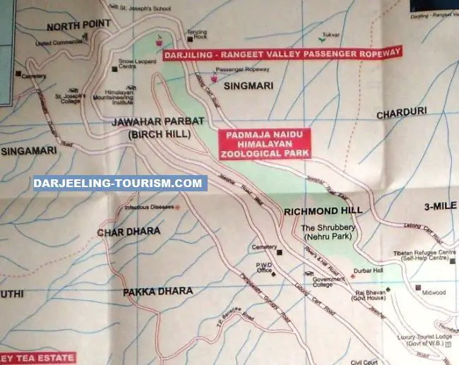
Map of North Darjeeling
The northern map of Darjeeling will be helpful if you are planning to visit the attractions in the northern part of the hill town. This includes the stretch of Jawahar Road that goes by the
Shrubbery Nightingale Park in Richmond Hill, and all the way to
HMI (Himalayan Mountaineering Institute) and the
Zoo located in the Jawahar Parvat area (i.e. Birch Hill).
Another section of the Map traces the Lebong Cart Road which goes via the
Old Cemetery towards Singamari. Singamari is where the
Ropeway (Darjeeling Rangeet Valley Passenger Ropeway or cable car) base station is located. Lebong Cart Road continues and goes all the way to the North Point St. Joseph's college and then turns towards
Tenzing Rock.
Note that there is another cemetery shown in the map near the St. Joseph's college. That is the Singtom Cemetery. The old British cemetery is only about a mile from Chowk Bazar. The Birch Hill where the HMI & Zoo are located can also be accessed from the Lebog Cart Road.
Map of North Darjeeling
You can also see the
Tibetan Refugee Self Help Center which is located on an uphill approach road that originates from the Lebong Cart Road. Another area of interest in this map is the
Happy Valley Tea Estate which can be accessed through the narrow and steep TP Banerjee road. It is shown in the map at the left bottom.
Related Articles
|
Visitors' Reviews/Comments
Share your experience.
|