Day-2 of Sandakphu Trek: Tonglu to Kalipokhri
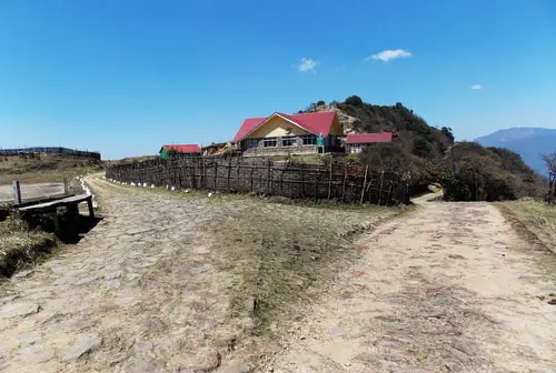
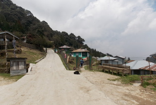
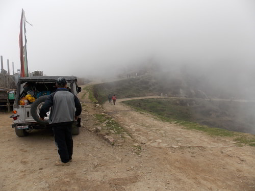
The second day of the trek to Sandakphu starts from Tonglu. Tonglu is a small village located at an altitude of 10,130ft. From here, there is a trekking trail that goes to another small settlement known as Tumling.
Tonglu, GTA Trekkers Hut
From Tumling, the final destination in Day-3 is a small village in Nepal known as Kalipokhri. You will need to cover a distance of 15kms on this day which can take 6-7 Hours of trekking. So, you should start early from Tonglu.
Below is a full description of the places and the trail on this section.
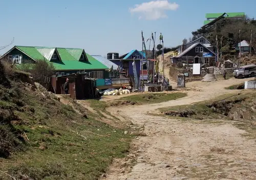
Tumling
(2kms from Tonglu, Altitude: 9,600ft), +1 hour trek
2kms trek from Tonglu will take you to another small Village called Tumling located at an altitude of 9,600 ft. Tonglu to Tumling is a steep descend, but thereafter it's a gradual descend till Gairibas.
Tumling is a great place to stop for a while, freshen up and then get moving for the next leg of the trek. Some trekkers actually prefer to stay at Tumling for the first night instead of at Tonglu. This is due to availability of better private lodges and facilities here.
Tumling Village
This is the last point up to which electricity is available. However solar powered lights are available all through the trek. Electricity is now available in Sandakphu as well which is provided through grids from Nepal.
Go through
Tumling Village for detailed information about what to expect there including available accommodations, amenities, attractions etc.
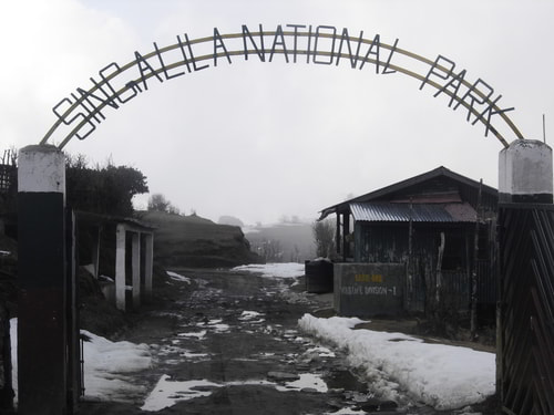
Entry to Singalila National Park
About 1km from Tumling you will reach the arched gateway of
Singalila National Park, which is the highest altitude national park in the state of West Bengal.
Singalila National Park Entry after Tumling
This park is well known for rare and fascinating high altitude animals like Red Panda, Pangolins, Himalayan black bear, Monals etc.
There is a check post here at Singalila gate. If you haven't taken the permit yet, this is where you must take it, or otherwise you won't be allowed to go any further.
Few yards inside the arched entrance of Singalila National Park, the road splits into three routes. The one on the left is a dirt road and goes through Nepal to a place called Jaubari and onward to Gairibas. You can see nice rolling meadows of Nepal on this route.
The other road straight ahead goes through a forested area all the way up to Gairibas. This road belongs to Indian territory and has now been concretized up to Gairibas. This route is used mostly by vehicles and also by many trekkers.
There is a narrow third route too (which is part of the actual trekking trail) that goes through the forest all the way up to Gairibas.
You can take any of the three routes. While the trek up to Jaubari is almost on a level terrain and is easy, after Jaubari the road becomes downhill and steep, and could get slippery if it rains.
If you want to avoid the steep downhill walk, then take the concrete road, or alternatively you can take the trekking trail if it is dry (because forest paths get muddy during rains).
Jaubari
(6kms from Tumling, Altitude: 9,186ft), +3 hours trek
Jaubari is a small village in Nepal at an altitude of 9,186 ft. If you take this route through Jaubari, stop here for a cup of tea. Fudri, a lady serves tea and light snacks from her home. She lives here with her husband and her daughter Yanzi.
Jaubari
On one occasion I had stayed back in Tumling for a night and came all the way to Jaubari to buy chicken. There was no chicken available in Tumling on that day (in fact non-veg is a luxury along this trek route).
My good friend and Nepali guide Sanjay suggested that I try out a drink called Roxy on our way back from Jaubari to Tumling. It's a specialty of this area, he mentioned.
This local drink is prepared from flowering plants locally known as Guras (actually rhododendrons) that grow quite abundantly in this part of the mountains.
He took me to a hut in Jaubari. It was a residence of a local family. An old lady poured a colorless pungent drink into a cup and offered it to me.
A few sips and soon my whole body got warmed up on that freezing night. I soon felt like some hot steam coming out of my ears and my body felt real light :)
While I don't advise that you should try such intoxicating drink, but just in case you do, take it in small quantity and have it real slow. But never try it while on a trek.
You can refill drinking water at Jaubari.
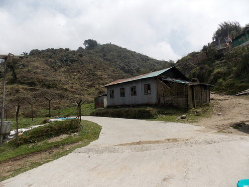
Gairibas
(3kms from Jaubari, Altitude: 8,600ft), +1 hour trek
The route from Jaubari goes through forest of bamboo and rhododendrons and turns right towards Gairibas. Gairibas is 3kms ahead of Jaubari and located at an altitude of 8,600 ft.
From Tumling up to Jaubari is a gradual descend and a relatively easy trek. But after Jaubari, it is a steep descend up to Gairibas.
Gairibas Village
Halt at Gairibas for a while. There is a tea stall here (which also has dormitory beds for trekkers). Piping hot vegetarian momos are great (no non-veg items). If you started early in the morning, you can complete your breakfast here or have some tea, before you proceed towards Sandakphu.
The stall also offers noodles, toast and other snack items, and even meals. You can get packaged snacks, biscuits, soft drinks and bottled water here as well. Opposite to the stall is a check post of Armed Border Force.
The three routes that originate shortly after entry to Singalila National Park (a concrete road through forest, a dirt road through Jaubari of Nepal, and a trekking trail) all come and meet here at Gairibas.
Three routes meet at Gairibas. The main concrete road is on front.
From upper right comes the route from Jaubari,
and at upper left is the trekking trail.
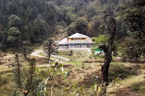
There is a nice GTA lodge at Gairibas (about 100 yards before you reach the check post and located at a lower level on a grassy flat land). The landscape around is picturesque with pine trees and lot other plantations. This is the best accommodation here.
During high season, it may not be easy to get accommodation at Gairibas, unless you have booked it in advance. Because of the scenic beauty of this place, many prefer to stay here for a night before proceeding for Sadakphu next morning. Magnolia Lodge is also popular among the trekkers for a night halt.
GTA Lodge, Gairibas
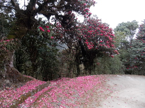
The trek route passes through bamboo glades. Gairibas is essentially a valley full of bamboo grooves. If you are here during spring (March - April), you can see colorful red Rhododendrons in full blossom.
Rhododendrons, shortly after Gairibas
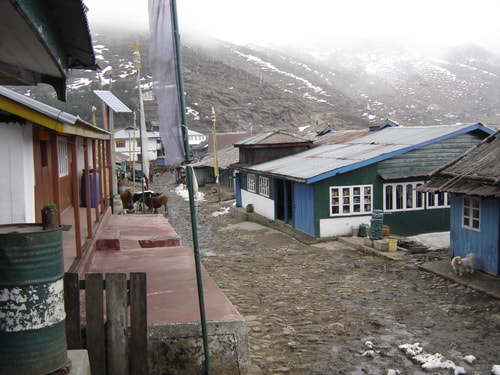
Kalipokhri
(6kms from Gairibas, Altitude: 10,400ft) +3 hours trek
From Gairibas, the route is a steep climb for about 2kms till you reach a tiny settlement known as Kaiyakatta. There are only couple of stalls here where you can get refreshment and water. The place gets its name from a strange story.
A Marwari man used to run a business here. Marwaris are locally known as Kaiya. However this man deprived the locals to keep most profits for himself. One day a furious local person beheaded him (an act known as katta). The place is since known as Kaiyakatta.
Kaiyakatta
From Kaiyakatta, there are two routes. The trail at the upper level goes through Nepal. However most take the other route that goes through Indian territory.
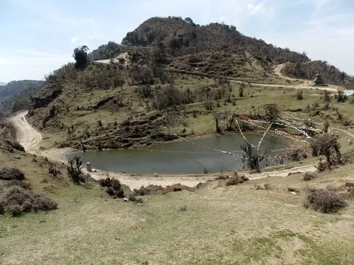
Both routes finally meet at Kalipokhri where the Kalipokhri lake is located. From Kaiyakatta, it's a gradual climb till you reach Kalipokhri.
From Gairibas, the trek up to Kalipokhri takes about three hours. Kalipokhri is at an altitude of 10,400 ft. Initially you will trek uphill through forests of oak, rhododendrons and bamboo to reach Kaiyakatta in about 1.5 hours which is about 2kms from Gairibas. The trail is up and down from here. In another 1.5 hours, you will reach Kalipokhri.
Kalipokhri is so named because of a pond or a water tank filled with black water. The word Kali means black and pokhri stands for water area. However the black color is not due to pollution, it's muddy and the water never freezes.
Kalipokhri Water Body
See the trail on upper right which comes from
Kaiyakatta through Nepal and meets here
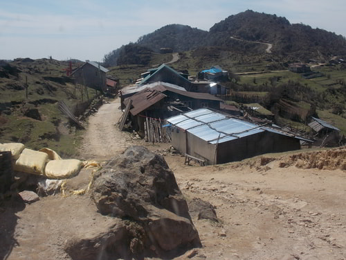
The small lake is considered sacred by the local villagers. Due to all-time water availability, a small village settlement has taken place in this area (about 100 yards ahead at a higher level). This is where all private trekkers huts are also located.
You will pass through forest of rhododendron, Singalila Sanctuary and then by the pond to reach the Kalipokhri village area.
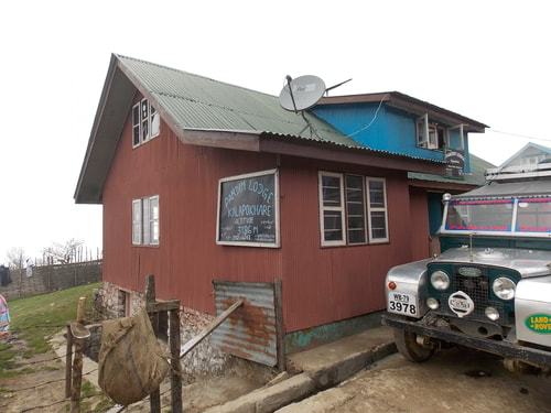
This is where most of the trekkers stay for the second night. There are several private lodges here including Pandim Lodge, Chewang Lodge, and Himchuli Lodge.
Kalipokhri Village
There is no GTA lodge here, but the private ones also offer similar accommodations at reasonable rates. Drinking water is available at both Kaikatta and Kalipokhri villages. Being in Nepal, foreign nationals can not stay at Kalipokhri overnight.
Pandim Lodge at Kalipokhri
As you are entering the village, look up 45 degrees towards left, and you can get the first glimpse of your targeted destination far away on a clear day... Sandakphu.
Related Articles
|
Visitors' Reviews/Comments
|