Day-1 of Sandakphu Trek: Manebhanjan to Tonglu
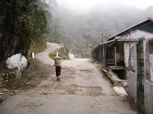
The usual trek for Sandakphu from the Indian side typically starts from Manebhanjan which is a small rural township in Darjeeling district.
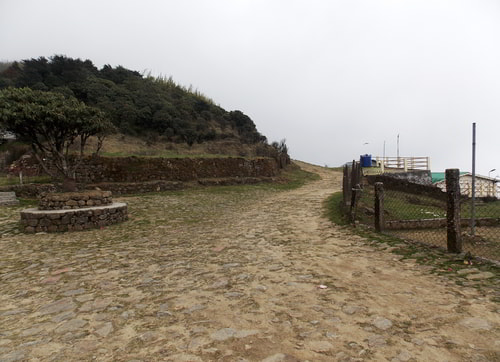
Winding route starts from Manebhanjan to Sandakphu on the left
On the first day (Day-1), you will trek from Manebhanjan (located at an altitude of 7,054ft) up to Tonglu which is a small hamlet located at an altitude of 10,130ft.
The total trek duration on Day-1 is 6-7 hours covering a distance of 11kms. Below is a full description of the places and the trail on this section.
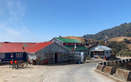
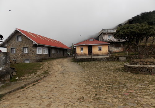
Manebhanjan
(Also known as Mane Bhanjyang), Altitude: 7,054ft
Many trekkers come to Manebhanjan a day before the trekking starts. This is to acclimatize themselves with the conditions before starting the trek early next morning.
Manebhanjan is a small settlement. There is no ATM here. In order to get cash, you will need to visit the nearest ATM is at Sukhiapokhri which is about 15-20 minutes by car (it would be on your way when you arrive at Manebhanjan).
Manebhanjan
There are a few small hotels and homestays here for overnight stays. Many small grocery and stationery shops are available at the market area to pick up your provisions like packaged water, biscuits, peanuts, dry food, medicines etc.
As you walk from Manebhanjan market area towards the trail for Sandakphu, in about 10-12 minutes, you will reach the office of the Singalila Wildlife Division. This is where you get the permit for Singalila National Park.
Chitre
(3kms from Manebhanjan, Altitude: 8,340ft), 1.5 hours trek
Chitre is a small village about 3kms from Manebhanjan located at an altitude of 8,340 ft. The route up to Chitre passes through pine, fir, birch forests and bamboo glades.
This part of the trek route is very steep and really warms you up. It takes about 1.5 hours to trek up to Chitre. You will get drinking water here as well as food in a local restaurant.
Many not-so-seasoned trekkers actually take a vehicle up to this point and then start the trek. This is to avoid the steep gradient.
But there are steeper sections ahead which you can't avoid, particularly the last 2kms of the trail to Sandakphu. So better start getting used to the steep ascent here.
The sharp hairpin turn at Chitre (now it's a concrete road)
There is an old Buddhist Monastery at Chitrey, a lodging for trekkers, a local restaurant and few village huts. You will pass by the monastery.
If you want to take it easy, visit the monastery. Then walk a few minutes and you will see a local restaurant on an open field. You can get food and water here, as well as toilet facilities. Halt for a while, freshen up and start the next leg of the trek.
Lamaydhura
(Further 3kms, Altitude: 8,792ft), +1.5 hours trek
Lamaydhura is a hamlet inhabited only by five odd Tibetan families. This part of the trek is more comfortable than the earlier stretch up to Chitre. It's a steady but gradual incline from Chitre and takes over an hour of trek.
Lamaydhura
You will get drinking water here as well as snack-type food like noodles, eggs etc as well as tea/coffee, cold drinks, packaged snacks etc from roadside stalls.
There are beds available for trekkers as well (low budget though and with makeshift toilets). From here, one side of the road is part of Nepal, while the other side is in India. The stalls at Lamaydhura have display boards showing they are in Nepal.
Go through
Lamaydhura for more information about this tiny settlement.
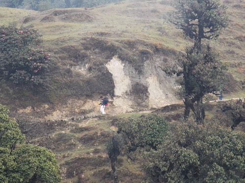
The trail from Lamaydhura ascends gradually. So this part of the trek is relatively easy. As you walk further up towards Meghma, you will pass though forests full of Chimal and Magnolia trees.
Route ahead of Lamaydhura. Do you see a trekker?
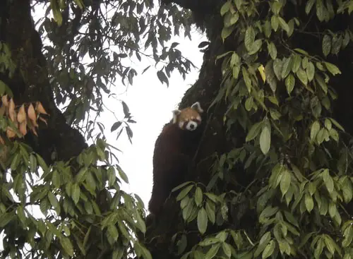
Shortly after Lamaydhura, I had one of my best experiences of trekking. We spotted a Red Panda crossing the trek route just yards ahead. I had always longed to see this rare and beautiful animal once in its natural form & habitat.
And here it was right in front of me, looking at me eye to eye. Initially it was puzzled having seen us, wondering whether to cross the road or return.
But soon it made up its mind, quickly crossed the road and started climbing a tree, and that's when I could finally capture it on my camera (see the picture below).
Red Panda climbing the tree
Meghma
(Further 3kms, Altitude 9,514ft), +1.5 hours trek
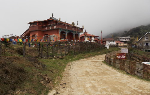
This is another small village located at the border of India and Nepal, and about 3kms from Lamaydhura. Meghma is at an altitude of 9,514 ft.
From Lamaydhura, it takes about 1.5 hours of trek to reach Meghma. If you trek continuously from Manebhanjan, it will take about 4.5-5 hours to reach Meghma. There is a monastery at the entrance of Meghma.
Armed border forces have a large camping site at Meghma. There is also a restaurant here serving tea, coffee, snacks, meals etc. A separate toilet facility is operated by the restaurant owner. There are limited beds available as well.
Meghma, the monastery on the left
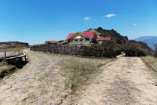
From Meghma the route bifurcates. The one on the right goes towards Tonglu (2kms) which is part of India. The trekkers usually take this route if they plan to stay at Tonglu. There is a GTA lodge here as well as a DM's bungalow.
If you do not want to stay at Tonglu but still like to take this route, then shortly before the GTA lodge a trekking trail bifurcates from the main route towards left and leads down to Tumling. Ask your guide and he will show you the way. This trail to Tumling is shorter.
Route from Meghma towards Tonglu
The route on the left from Meghma goes directly to the settlement
Tumling (2kms) which is part of Nepal. There are several private hotels and lodges in Tumling offering both rooms and dormitory beds. You can take any of the two routes you like.
If you take the route to Tonglu, you will need to trek for additional 2kms and the route finally merges at Tumling. Both Tonglu and Tumling offer spectacular views of Kanchenjunga on clear days.
Route from Meghma towards Tumling
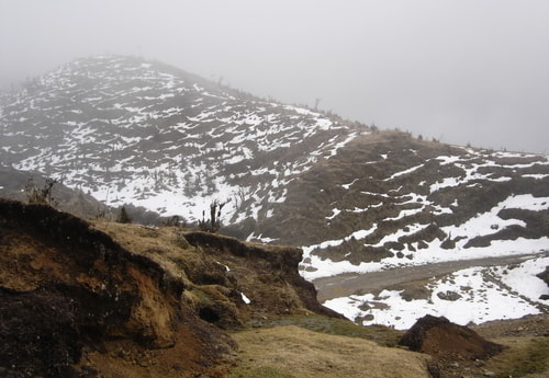
During winter time, it can get very cold from Meghma onwards and it would be wise to carry heavy woolens, jacket, cap and hand gloves and keep them handy. You will start seeing accumulated snow on both sides of the street soon after Meghma.
Once during winter I took the route from Meghma towards Tumling. You get to see open meadows, valleys, gorge and barren landscapes. And in winter they remain frozen in snow. The picture below was taken between Meghma and Tumling.
Meghma to Tumling, landscape in snow
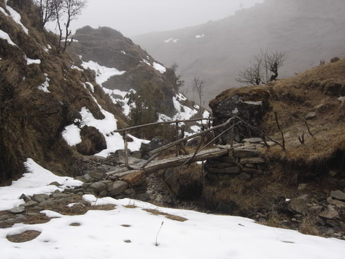
There are only handful of village huts along the way, hardly any vegetation and practically no facility for the trekkers on this route. However, you can remain immersed with nature's unabated beauty. And the terrain is relatively easy to let you enjoy that.
Meghma to Tumling, landscape in snow
But for now, we will take the route from Meghma towards Tonglu which is a more popular route for trekkers, because you get to see one more beautiful place - Tonglu.
Tonglu
(2kms from Meghma, Altitude: 10,130ft), +1 hour trek
Tonglu is a small hamlet located at an altitude of 10,130ft. This is where most trekkers take the first night halt. There is a GTA lodge here. The lodge is about 2kms from Meghma and takes about 1 hour to reach. The last section is a steep climb.
Tonglu, GTA Trekkers Hut
From Tonglu you can get lovely views of Darjeeling and Kurseong town areas. Down below you can see the great valleys and the plains of North Bengal with rivers like Teesta and Koshi flowing. Tonglu also offers a wonderful view of Kanchenjunga snow peaks.
In fact many discerning tourists and trekkers consider Tonglu as one of the best places in Darjeeling district offering stunning views of Kanchenjunga peaks.
Related Articles
|
Visitors' Reviews/Comments
|